|
|
Weather Alert |
| Summit County, OH | |||||||||
|
|
||||||||
|
Canceled 7/28/25 7:18 PM Tornado Warning issued July 28 at 7:06PM EDT until July 28 at 7:30PM EDT by NWS Cleveland OH TORCLE The National Weather Service in Cleveland has issued a * Tornado Warning for... Southeastern Medina County in northeastern Ohio... Southwestern Summit County in northeastern Ohio... Northeastern Wayne County in northeastern Ohio... * Until 730 PM EDT. * At 706 PM EDT, a severe thunderstorm capable of producing a tornado was located near Rittman, or 9 miles northeast of Wooster, moving northeast at 30 mph. HAZARD...Tornado. SOURCE...Radar indicated rotation. IMPACT...Flying debris will be dangerous to those caught without shelter. Mobile homes will be damaged or destroyed. Damage to roofs, windows, and vehicles will occur. Tree damage is likely. * This dangerous storm will be near... Barberton, Wadsworth, Rittman, and Doylestown around 710 PM EDT. Other locations impacted by this tornadic thunderstorm include Norton, Clinton, and Portage Lakes. 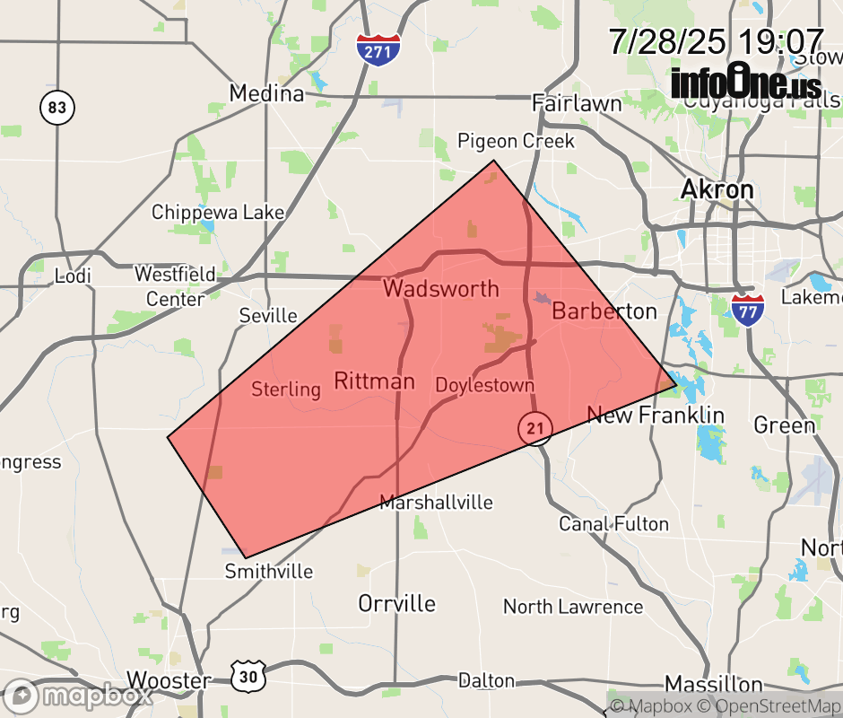 |
|||||||||
 Why aren't you using the InfoOne app? Why aren't you using the InfoOne app?
Stay abreast of information affecting your community! InfoOne tracks real-time information such as:
InfoOne currently supports over 100 communities in NC, VA and WV, and our coverage area is steadily growing. It's free! Install the InfoOne app today and see what you've been missing. |
|||||||||