|
|
Weather Alert |
| Stark County, OH | |||||||||
|
|
||||||||
|
Canceled 6/5/25 10:59 PM Flood Advisory issued June 5 at 7:53PM EDT until June 5 at 11:00PM EDT by NWS Cleveland OH * WHAT... Flooding caused by excessive rainfall is expected. * WHERE... A portion of northeast Ohio, including the following counties, Stark and Summit. * WHEN... Until 1100 PM EDT. * IMPACTS... Minor flooding in low-lying and poor drainage areas. Ponding of water in urban or other areas is occurring or is imminent. * ADDITIONAL DETAILS... - At 753 PM EDT, Doppler radar and automated rain gauges indicated heavy rain due to thunderstorms. Overflowing poor drainage areas will cause minor flooding in the advisory area. Between 1 and 2 inches of rain have fallen. - This includes the following streams and drainages... Little Sandy Creek, Hugle Run, Newman Creek, Limestone Creek, Breakneck Creek, Nimishillen Creek, Sugar Creek, Middle Fork Sugar Creek, Indian Run, East Branch Nimishillen Creek, Sherrick Run, Mahoning River, Sandy Creek, West Branch Nimishillen Creek, Beech Creek, Bean Creek, Mudbrook Creek, Nimisila Creek, Little Beech Creek, Elm Run, North Fork Sugar Creek and Tuscarawas River. Additional rainfall amounts of 0.1 to 0.5 inches are expected over the area. This additional rain will result in minor flooding. - Some locations that will experience flooding include... Canton, Massillon, Green, Alliance, North Canton, Louisville, Minerva, Hartville, Brewster, Navarre, Waynesburg, East Sparta, Wilmot, East Canton, Beach City, Meyers Lake, Hills And Dales, Limaville, Perry Heights and Greentown. - Please visit www.weather.gov/safety/flood for flood safety and preparedness information. 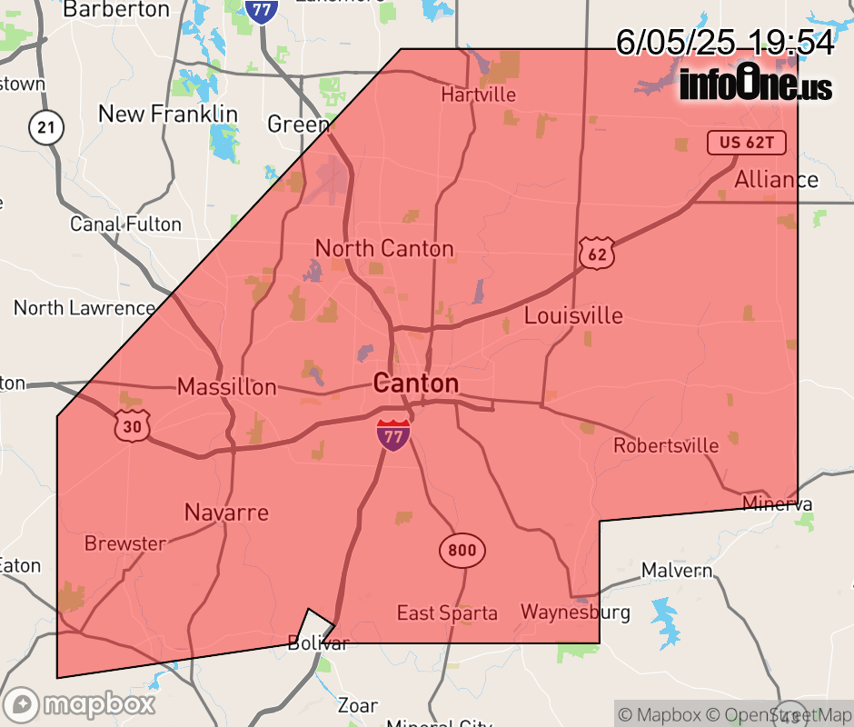 |
|||||||||
 Why aren't you using the InfoOne app? Why aren't you using the InfoOne app?
Stay abreast of information affecting your community! InfoOne tracks real-time information such as:
InfoOne currently supports over 100 communities in NC, VA and WV, and our coverage area is steadily growing. It's free! Install the InfoOne app today and see what you've been missing. |
|||||||||