|
|
Weather Alert |
| Franklin County, VA | |||||||||
|
|
||||||||
|
Canceled 8/1/25 3:03 PM Flash Flood Warning issued August 1 at 11:57AM EDT until August 1 at 6:00PM EDT by NWS Blacksburg VA FFWRNK The National Weather Service in Blacksburg has issued a * Flash Flood Warning for... Southwestern Bedford County in south central Virginia... Northern Franklin County in west central Virginia... Eastern Roanoke County in west central Virginia... The City of Roanoke in west central Virginia... * Until 600 PM EDT Friday. * At 1157 AM EDT, Doppler radar indicated thunderstorms producing heavy rain across the warned area. Between 1 and 2 inches of rain have fallen. The expected rainfall rate is 1 to 3 inches in 1 hour. Additional rainfall amounts up to 2 inches are possible in the warned area. Flash flooding is ongoing or expected to begin shortly. HAZARD...Flash flooding caused by thunderstorms. SOURCE...Radar. IMPACT...Flash flooding of small creeks and streams, urban areas, highways, streets and underpasses as well as other poor drainage and low-lying areas. * Some locations that will experience flash flooding include... Roanoke... Salem... Vinton... Boones Mill... Stewartsville... Moneta... Northwest Smith Mountain Lake... This includes the following streams and drainages... Back Creek, Blackwater River, Carter Mill Creek, Carvin Creek and Bunker Hill Creek. 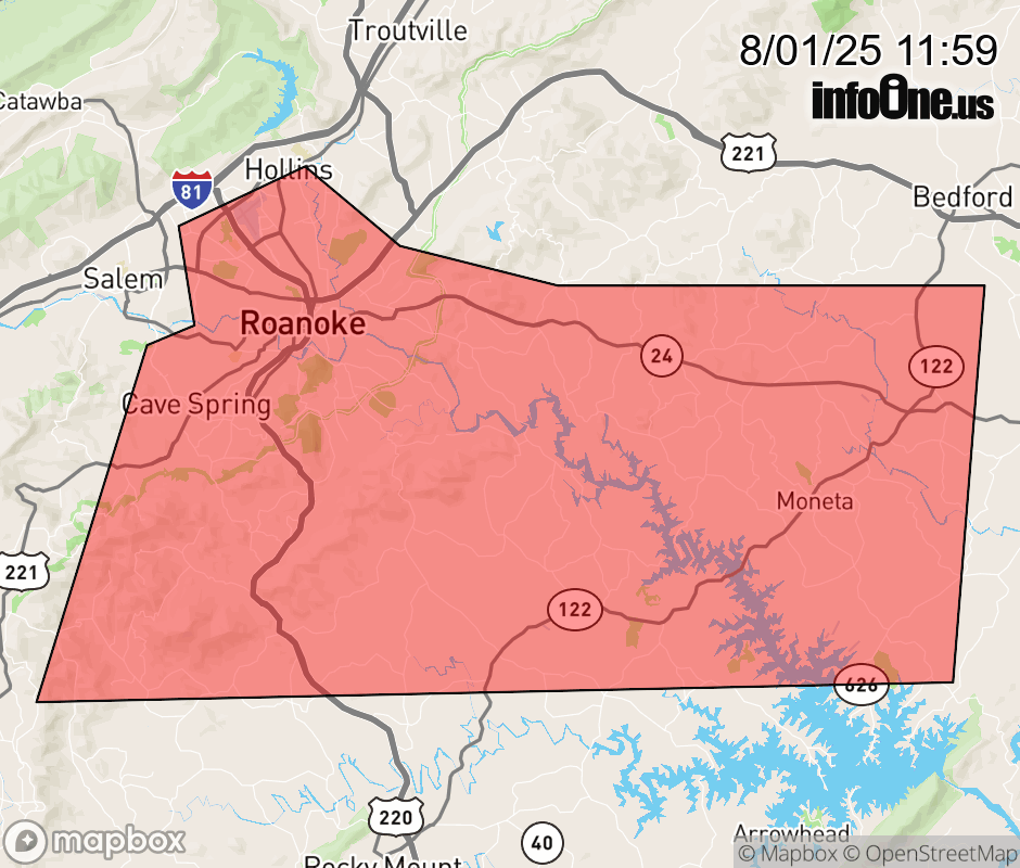 |
|||||||||
 Why aren't you using the InfoOne app? Why aren't you using the InfoOne app?
Stay abreast of information affecting your community! InfoOne tracks real-time information such as:
InfoOne currently supports over 100 communities in NC, VA and WV, and our coverage area is steadily growing. It's free! Install the InfoOne app today and see what you've been missing. |
|||||||||