|
|
Weather Alert |
| Granville County, NC | |||||||||
|
|
||||||||
|
Canceled 6/10/26 4:20 PM Severe Thunderstorm Warning issued June 10 at 4:05PM EDT until June 10 at 4:30PM EDT by NWS Raleigh NC SVRRAH The National Weather Service in Raleigh has issued a * Severe Thunderstorm Warning for... Northern Vance County in central North Carolina... Northeastern Granville County in central North Carolina... * Until 430 PM EDT. * At 405 PM EDT, a severe thunderstorm was located near Clarksville, or 14 miles east of Virgilina, moving southeast at 30 mph. HAZARD...60 mph wind gusts and nickel size hail. SOURCE...Radar indicated. IMPACT...Expect damage to roofs, siding, and trees. * Locations impacted include... Middleburg, Tungsten, Satterwhite Point Marina, Steele Creek Marina & Campground, Bullocksville, Kerr Lake, and John H Kerr Reservoir. This includes Interstate 85 between Mile Markers 220 and 222. 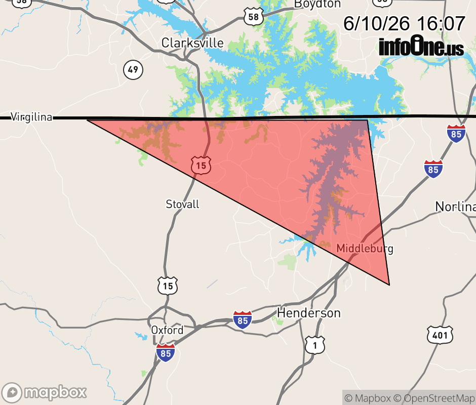 |
|||||||||
 Why aren't you using the InfoOne app? Why aren't you using the InfoOne app?
Stay abreast of information affecting your community! InfoOne tracks real-time information such as:
InfoOne currently supports over 100 communities in NC, VA and WV, and our coverage area is steadily growing. It's free! Install the InfoOne app today and see what you've been missing. |
|||||||||