|
|
Weather Alert |
| Teller County, CO | |||||||||
|
|
||||||||
|
Canceled 7/30/25 1:14 PM Flood Watch issued July 30 at 2:59AM MDT until July 30 at 10:00PM MDT by NWS Pueblo CO * WHAT... Flash flooding caused by excessive rainfall is possible. * WHERE... Portions of central, east central, and southeast Colorado, including the following areas, in central Colorado, Canon City Vicinity/Eastern Fremont County, Northwestern Fremont County Above 8500 Feet, Pikes Peak Above 11000 Feet, Teller County/Rampart Range Above 7500 Feet/Pikes Peak Between 7500 And 11000 Feet and Western/Central Fremont County Below 8500 Feet. In east central Colorado, Colorado Springs Vicinity/Southern El Paso County/Rampart Range Below 7400 Feet and Northern El Paso County/Monument Ridge/Rampart Range Below 7500 Feet. In southeast Colorado, Eastern Las Animas County, Sangre de Cristo Mountains, Pueblo Vicinity/Pueblo County Below 6300 Feet, Trinidad Vicinity/Western Las Animas County Below 7500 Feet, Walsenburg Vicinity/Upper Huerfano River Basin Below 7500 Feet, Wet Mountain Valley Below 8500 Feet, and the Wet Mountains. * WHEN... From 1 PM MDT this afternoon through this evening. * IMPACTS... Excessive runoff may result in flooding of rivers, creeks, streams, and other low-lying and flood-prone locations. Flooding may occur in poor drainage and urban areas. * ADDITIONAL DETAILS... - http://www.weather.gov/safety/flood 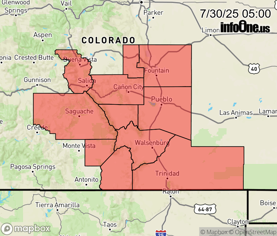 |
|||||||||
 Why aren't you using the InfoOne app? Why aren't you using the InfoOne app?
Stay abreast of information affecting your community! InfoOne tracks real-time information such as:
InfoOne currently supports over 100 communities in NC, VA and WV, and our coverage area is steadily growing. It's free! Install the InfoOne app today and see what you've been missing. |
|||||||||