|
|
Weather Alert |
| Stark County, OH | |||||||||
|
|
||||||||
|
Canceled 7/31/25 12:50 AM Severe Thunderstorm Warning issued July 31 at 12:29AM EDT until July 31 at 1:15AM EDT by NWS Cleveland OH SVRCLE The National Weather Service in Cleveland has issued a * Severe Thunderstorm Warning for... Southeastern Medina County in northeastern Ohio... West central Stark County in northeastern Ohio... Southwestern Summit County in northeastern Ohio... Northern Wayne County in northeastern Ohio... * Until 115 AM EDT. * At 1229 AM EDT, severe thunderstorms were located along a line extending from near Lodi to near Wooster, moving east at 30 mph. HAZARD...60 mph wind gusts. SOURCE...Radar indicated. IMPACT...Expect damage to trees and power lines. * Locations impacted include... Akron, Canton, Wooster, Massillon, Barberton, Green, Wadsworth, North Canton, Orrville, Rittman, Doylestown, Creston, Dalton, New Franklin, Norton, Canal Fulton, Seville, Smithville, Clinton, and Marshallville. 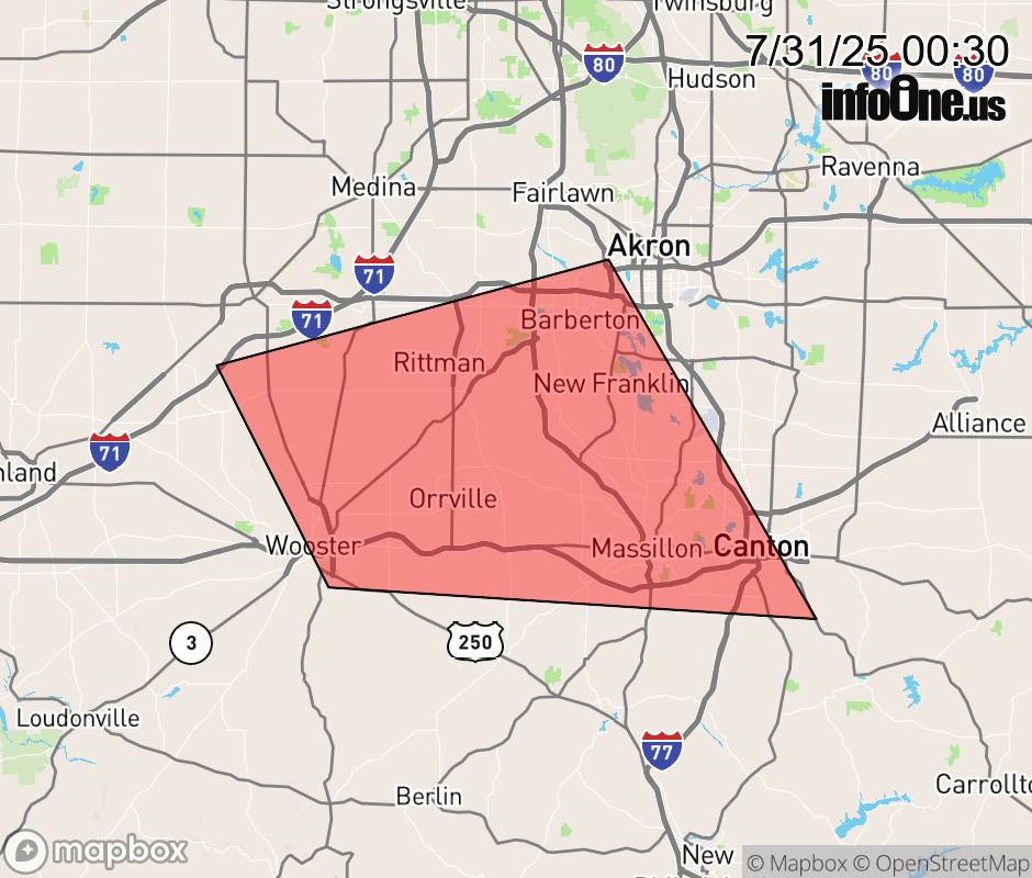 |
|||||||||
 Why aren't you using the InfoOne app? Why aren't you using the InfoOne app?
Stay abreast of information affecting your community! InfoOne tracks real-time information such as:
InfoOne currently supports over 100 communities in NC, VA and WV, and our coverage area is steadily growing. It's free! Install the InfoOne app today and see what you've been missing. |
|||||||||