|
|
Weather Alert |
| Franklin County, OH | |||||||||
|
|
||||||||
|
Canceled 6/14/26 3:43 PM Severe Thunderstorm Warning issued June 14 at 3:31PM EDT until June 14 at 4:15PM EDT by NWS Wilmington OH SVRILN The National Weather Service in Wilmington has issued a * Severe Thunderstorm Warning for... Southeastern Champaign County in west central Ohio... Western Franklin County in central Ohio... Southwestern Delaware County in central Ohio... Northeastern Clark County in west central Ohio... Southern Union County in central Ohio... Madison County in central Ohio... * Until 415 PM EDT. * At 330 PM EDT, severe thunderstorms were located along a line extending from 7 miles northeast of Mechanicsburg to 6 miles east of Springfield, moving east at 40 mph. HAZARD...60 mph wind gusts. SOURCE...Radar indicated. IMPACT...Expect damage to trees and power lines. * Locations impacted include... Columbus, Springfield, Dublin, Westerville, Grove City, Upper Arlington, Hilliard, Marysville, Worthington, London, Jefferson, Powell, Plain City, West Jefferson, Mechanicsburg, Minerva Park, Choctaw Lake, New California, Polaris, and Ohio State University. This includes the following Interstates... I-70 in Ohio between mile markers 53 and 99. I-71 in Ohio near mile marker 106 and 123. 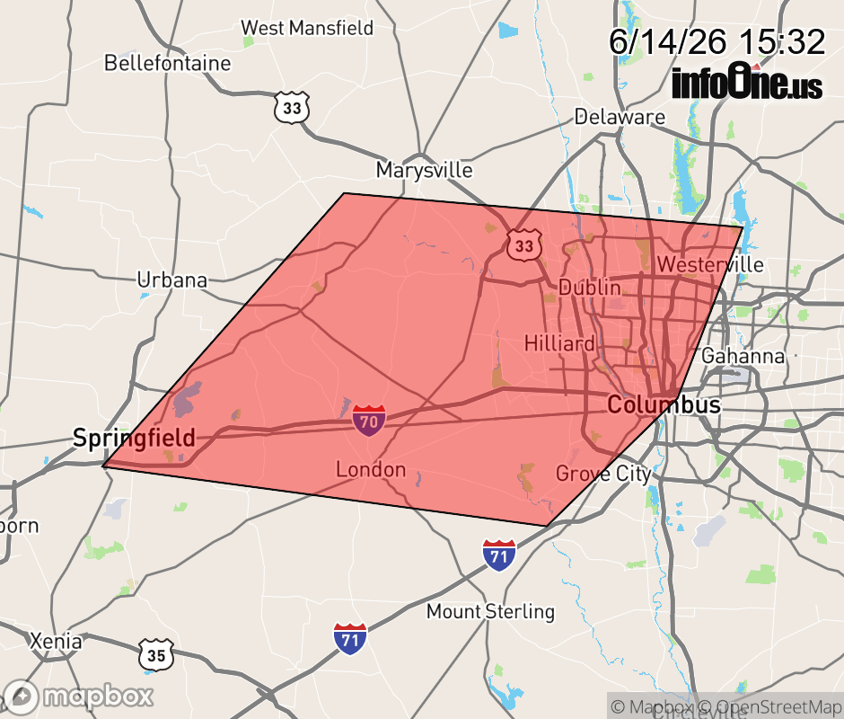 |
|||||||||
 Why aren't you using the InfoOne app? Why aren't you using the InfoOne app?
Stay abreast of information affecting your community! InfoOne tracks real-time information such as:
InfoOne currently supports over 100 communities in NC, VA and WV, and our coverage area is steadily growing. It's free! Install the InfoOne app today and see what you've been missing. |
|||||||||