|
|
Weather Alert |
| Webster County, WV | |||||||||
|
|
||||||||
|
Canceled 7/31/25 1:54 AM Flash Flood Warning issued July 31 at 12:49AM EDT until July 31 at 2:00AM EDT by NWS Charleston WV At 1249 AM EDT, Doppler radar indicated thunderstorms produced heavy rain across the warned area, but Emergency Management had not received any reports of flooding. Between 2 and 4 inches of rain have fallen. Flooding impacts may arise, but no additional rainfall is expected. HAZARD...Flash flooding caused by thunderstorms. SOURCE...Radar. IMPACT...Flash flooding of small creeks and streams, urban areas, highways, streets and underpasses as well as other poor drainage and low-lying areas. Some locations that will experience flash flooding include... Mingo, Huttonsville, Monterville, Valley Head, Waneta and Bergoo. 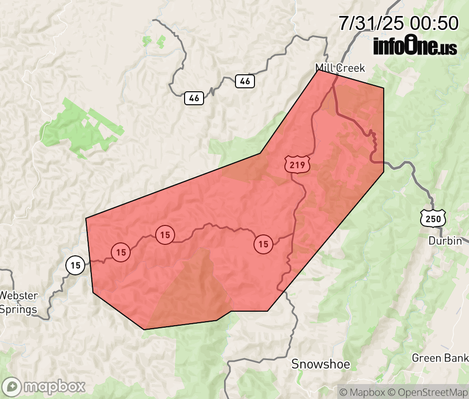 |
|||||||||
 Why aren't you using the InfoOne app? Why aren't you using the InfoOne app?
Stay abreast of information affecting your community! InfoOne tracks real-time information such as:
InfoOne currently supports over 100 communities in NC, VA and WV, and our coverage area is steadily growing. It's free! Install the InfoOne app today and see what you've been missing. |
|||||||||