|
|
Weather Alert |
| Medina County, OH | |||||||||
|
|
||||||||
|
Canceled 4/15/26 5:13 PM Severe Thunderstorm Warning issued April 15 at 4:56PM EDT until April 15 at 5:45PM EDT by NWS Cleveland OH SVRCLE The National Weather Service in Cleveland has issued a * Severe Thunderstorm Warning for... Huron County in north central Ohio... Erie County in north central Ohio... Northwestern Medina County in northeastern Ohio... Lorain County in north central Ohio... * Until 545 PM EDT. * At 456 PM EDT, a severe thunderstorm was located 7 miles southwest of Norwalk, moving east at 50 mph. HAZARD...60 mph wind gusts and quarter size hail. SOURCE...Radar indicated. IMPACT...Minor damage to vehicles is possible. Expect damage to trees and power lines. * Locations impacted include... Lorain, Elyria, Sandusky, Norwalk, Western Vermilion, Vermilion, North Ridgeville, Avon Lake, Amherst, Bellevue, Grafton, Willard, Wellington, Northern Milan, Milan, Wakeman, Avon, Bay Village, Sheffield Lake, and Eaton. 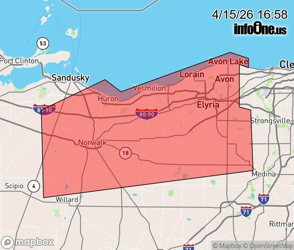 |
|||||||||
 Why aren't you using the InfoOne app? Why aren't you using the InfoOne app?
Stay abreast of information affecting your community! InfoOne tracks real-time information such as:
InfoOne currently supports over 100 communities in NC, VA and WV, and our coverage area is steadily growing. It's free! Install the InfoOne app today and see what you've been missing. |
|||||||||