|
|
Weather Alert |
| Medina County, OH | |||||||||
|
|
||||||||
|
Canceled 4/15/26 4:05 PM Severe Thunderstorm Warning issued April 15 at 3:51PM EDT until April 15 at 4:30PM EDT by NWS Cleveland OH SVRCLE The National Weather Service in Cleveland has issued a * Severe Thunderstorm Warning for... Northeastern Huron County in north central Ohio... Erie County in north central Ohio... Northwestern Medina County in northeastern Ohio... Lorain County in north central Ohio... * Until 430 PM EDT. * At 350 PM EDT, a severe thunderstorm was located near Wakeman, or near Norwalk, moving east at 55 mph. HAZARD...60 mph wind gusts and half dollar size hail. This storm may be rotating. SOURCE...Radar indicated. IMPACT...People and animals outdoors will be injured. Expect hail damage to roofs, siding, windows, and vehicles. Expect damage to trees and power lines. * Locations impacted include... Elyria, Norwalk, North Ridgeville, Grafton, Wellington, Wakeman, Avon, Eaton, Oberlin, Sheffield, Lagrange, Penfield, South Amherst, Pittsfield, Kipton, and Eaton Estates. 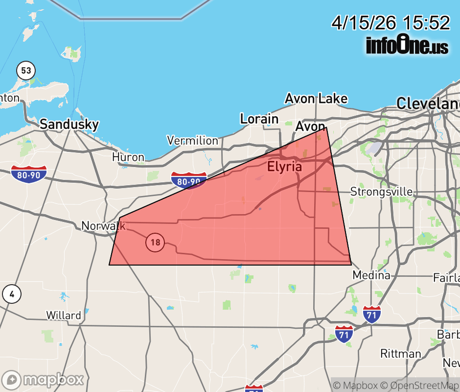 |
|||||||||
 Why aren't you using the InfoOne app? Why aren't you using the InfoOne app?
Stay abreast of information affecting your community! InfoOne tracks real-time information such as:
InfoOne currently supports over 100 communities in NC, VA and WV, and our coverage area is steadily growing. It's free! Install the InfoOne app today and see what you've been missing. |
|||||||||