
|
Weather Alert |
| Raleigh County, WV | |||||||||
|
|
||||||||
|
Canceled 7/28/26 2:45 PM Special Weather Statement issued July 28 at 2:18PM EDT by NWS Charleston WV At 217 PM EDT, Doppler radar was tracking a strong thunderstorm 7 miles southeast of Burnwell, or 12 miles southwest of Fayetteville, moving southeast at 45 mph. HAZARD...Wind gusts up to 50 mph and half inch hail. SOURCE...Radar indicated. IMPACT...Gusty winds could knock down tree limbs and blow around unsecured objects. Minor hail damage to vegetation is possible. Locations impacted include... Beckley, Oak Hill, Mount Hope, Bradley, Prosperity, Piney View, Stanaford, Powellton, Pax, Thurmond, and Artie. This includes the following highways... West Virginia Turnpike between mile markers 47 and 65. Interstate 64 in West Virginia between mile markers 125 and 131. Route 19 between mile markers 1 and 13. 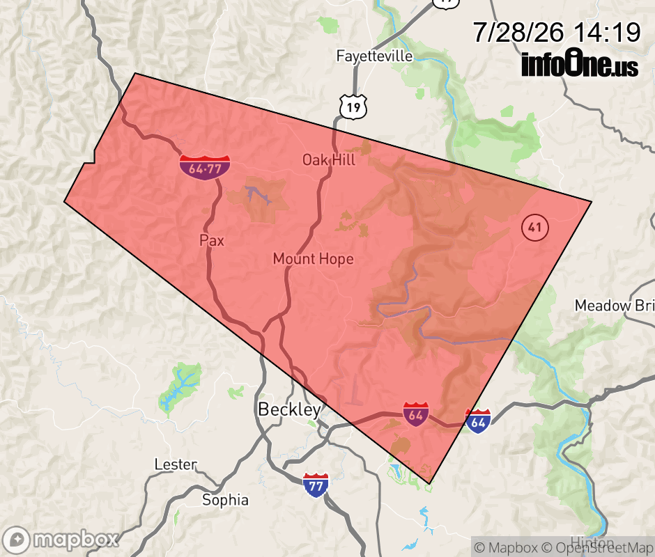 |
|||||||||
 Why aren't you using the InfoOne app? Why aren't you using the InfoOne app?
Stay abreast of information affecting your community! InfoOne tracks real-time information such as:
InfoOne currently supports over 100 communities in NC, VA and WV, and our coverage area is steadily growing. It's free! Install the InfoOne app today and see what you've been missing. |
|||||||||