|
|
Weather Alert |
| Lewis County, WV | |||||||||
|
|
||||||||
|
Canceled 7/27/25 4:30 PM Special Weather Statement issued July 27 at 3:58PM EDT by NWS Charleston WV At 358 PM EDT, Doppler radar was tracking a strong thunderstorm 10 miles northeast of Glenville, moving southeast at 30 mph. HAZARD...Wind gusts up to 40 mph and pea size hail. SOURCE...Radar indicated. IMPACT...Gusty winds could knock down tree limbs and blow around unsecured objects. Minor hail damage to vegetation is possible. Locations impacted include... Weston, Stonewall Jackson, Jackson Mill, Burnsville, Sand Fork, Auburn, Camden, Baldwin, Sand Run, Stouts Mills, Grove, Leopold, Troy, Newberne, Walkersville, Alum Bridge, Ireland, Coxs Mills, Linn, and Horner. This includes the following highways... Interstate 79 between mile markers 78 and 102. 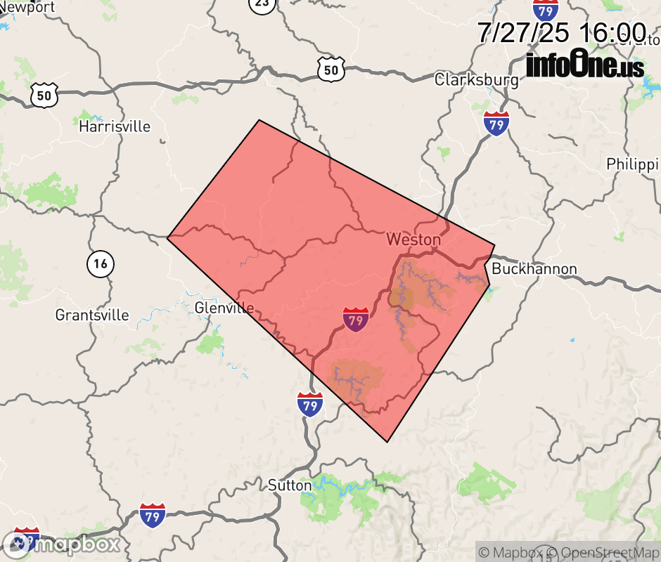 |
|||||||||
 Why aren't you using the InfoOne app? Why aren't you using the InfoOne app?
Stay abreast of information affecting your community! InfoOne tracks real-time information such as:
InfoOne currently supports over 100 communities in NC, VA and WV, and our coverage area is steadily growing. It's free! Install the InfoOne app today and see what you've been missing. |
|||||||||